Log in
All resources
Create a design
1,486 Free Images of Maps Of Africa
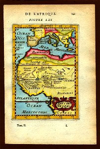
description de l'universe
maps from the earth and its inhabitants, vol. xi
africa in the 1890s
bibliothèque nationale de france
koninklijke bibliotheek
alain manesson mallet
1667 maps
atlas maior, vol 10 (spain and africa) - joan blaeu, 1667 - bl 114.h(star).10
copper engraving print
british library
description de l'universe
1680s maps of africa
description de l'universe
old maps of africa
description de l'universe
old maps of africa
description de l'universe
old maps of africa
maps from the earth and its inhabitants, vol. xi
africa in the 1890s
maps from the earth and its inhabitants, vol. xi
africa in the 1890s
maps from the earth and its inhabitants, vol. xi
africa in the 1890s
picturesque journey to the two americas, asia and africa
1842 in bolivia
maps from the earth and its inhabitants, vol. xi
africa in the 1890s
map of ancient assyria by philippe de la rué
maps
arnold van langren map of southwest africa
renaissance
maps from the earth and its inhabitants, vol. xii
1710s maps of africa
maps from the earth and its inhabitants, vol. xiii
maps of orange free state
dr. wilh. junker's reisen in afrika 1875-1886
1880s maps of sudan
carte de l'afrique françoise par guillaume delisle (1726)
philippe buache
eran laor cartographic collection
william henry toms
synopsis universae philologiae
1741 maps of europe
victor levasseur - maps of the world
french algeria
description de l'universe
history of africa
atlas maior, vol 10 (spain and africa) - joan blaeu, 1667 - bl 114.h(star).10
1667 maps
maps in musée de la compagnie des indes
images requiring restoration
atlas maior, vol 10 (spain and africa) - joan blaeu, 1667 - bl 114.h(star).10
1667 maps
atlas maior, vol 10 (spain and africa) - joan blaeu, 1667 - bl 114.h(star).10
1667 maps
maps from the earth and its inhabitants, vol. xiii
maps of telegraph lines
maps from the earth and its inhabitants, vol. xi
1870s maps of tunisia
old maps of south africa
emil holub
maps of the dutch east india company - south africa
1747 maps
1727 maps of africa
1720s maps of egypt
1727 maps of africa
1720s maps of egypt
maps from the earth and its inhabitants, vol. xi
africa in the 1890s
maps from the earth and its inhabitants, vol. xi
africa in the 1890s
maps from the earth and its inhabitants, vol. xi
africa in the 1890s
maps from the earth and its inhabitants, vol. xi
africa in the 1890s
maps from the earth and its inhabitants, vol. xi
africa in the 1890s
1660s maps of spain
1667 maps
18th-century maps of north africa
maps by tomas lopez
picturesque journey to the two americas, asia and africa
mines in chile
english-language maps
maps by john cary
maps of barbary coast by mercator-hondius
bibliothèque nationale de france
hendrik van langren map of south asia
1596 maps of asia
a.de la motraye's travels through europe, asia, and into part of africa (1723) by la mottraye
realism
1880s maps of south africa
emil holub
illustrations from five weeks in a balloon by riou and montaut
old maps of africa
maps from the earth and its inhabitants, vol. xi
africa in the 1890s
atlas maior, vol 10 (spain and africa) - joan blaeu, 1667 - bl 114.h(star).10
1667 maps
atlas maior, vol 10 (spain and africa) - joan blaeu, 1667 - bl 114.h(star).10
1667 maps
atlas maior, vol 10 (spain and africa) - joan blaeu, 1667 - bl 114.h(star).10
1667 maps
atlas maior, vol 10 (spain and africa) - joan blaeu, 1667 - bl 114.h(star).10
1667 maps
atlas maior, vol 10 (spain and africa) - joan blaeu, 1667 - bl 114.h(star).10
1667 maps
maps of peñón de vélez by braun & hogenberg
maps of tunis by braun & hogenberg
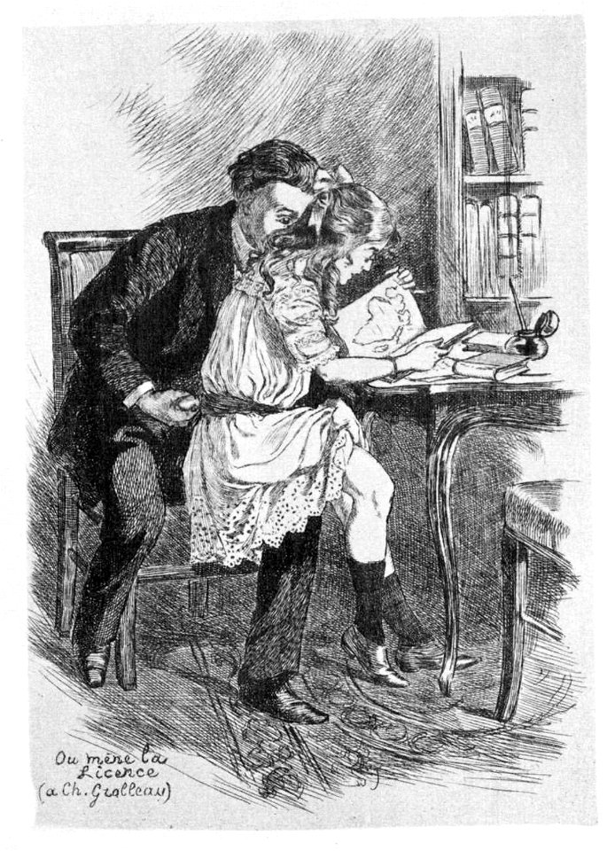
drawings of male masturbation
sexual petting in art
maps of the west-indische compagnie
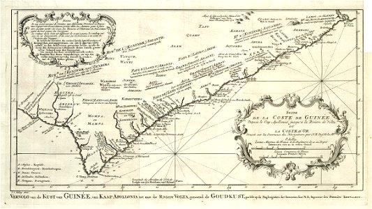
old maps of the dutch gold coast
old maps of south africa
maps of the great trek
maps from the earth and its inhabitants, vol. xi
maps indicating exploration
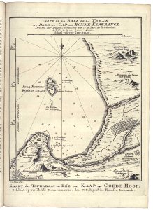
maps of the western cape
breede river
catalan atlas, 1959 reproduction
catalan atlas, 1959 reproduction
maps from the earth and its inhabitants, vol. xi
africa in the 1890s
maps from the earth and its inhabitants, vol. xi
africa in the 1890s
1800s maps of the iberian peninsula
maps by john cary
description de l'universe
maps of the blue nile
description de l'universe
1683 maps of africa
description de l'universe
maps of nubia
description de l'universe
1683 maps of africa
eran laor cartographic collection
jacques chiquet
maps of the west-indische compagnie
1668
maps of the dutch east india company - south africa
1747
picturesque journey to the two americas, asia and africa
puebla in art
1770s maps of morocco
maps by tomas lopez
maps of the ottoman empire by mercator-hondius
map
geographia universalis (1545) in the british museum
german renaissance,northern renaissance
description de l'universe
1683 maps of africa
description de l'universe
1683 maps of africa
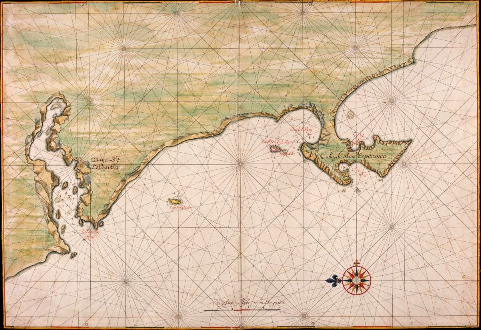
maps of the dutch east india company - south africa
1665
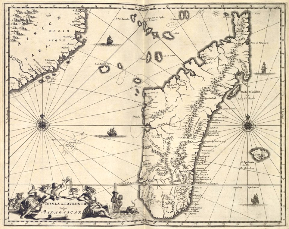
maps of the dutch east india company - mozambique
maps of the dutch east india company - madagascar
maps of the dutch east india company - south africa
1682
maps from the earth and its inhabitants, vol. xviii
colonialism
transvaal gold fields
glossinidae
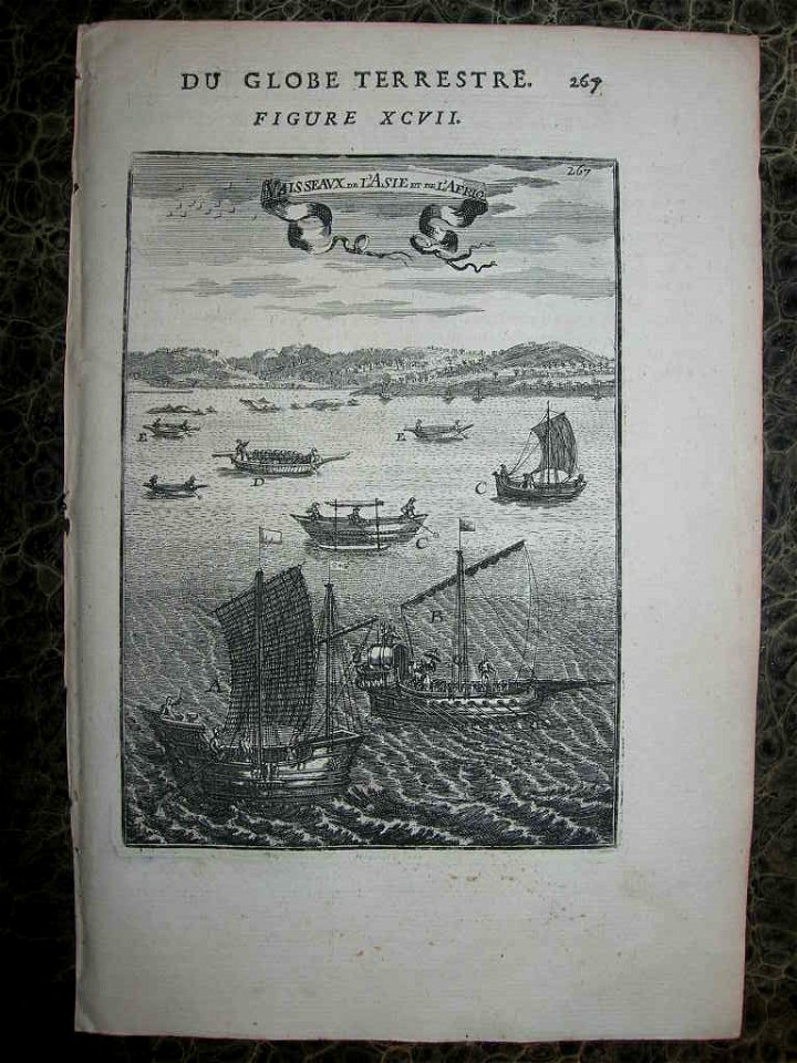
description de l'universe
1683 prints
description de l'universe
africa in art
illustrations from five weeks in a balloon by riou and montaut
old maps of africa
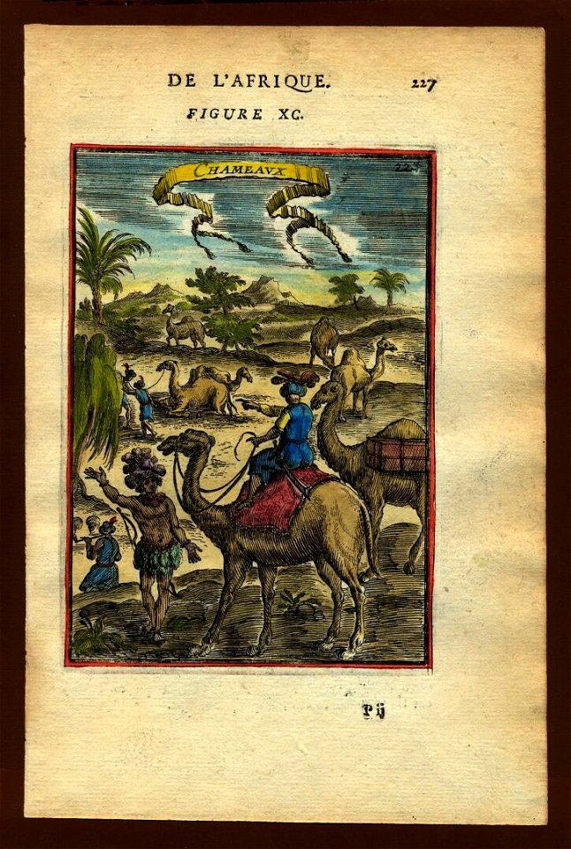
description de l'universe
1683 maps of africa
description de l'universe
1680s maps of africa
maps by pieter mortier
maps from gallica
maps from the earth and its inhabitants, vol. x
1880s maps of egypt
19th-century maps of somalia
1876 maps of africa
maps from the earth and its inhabitants, vol. x
1880s maps of egypt
synopsis universae philologiae
1741 maps of asia
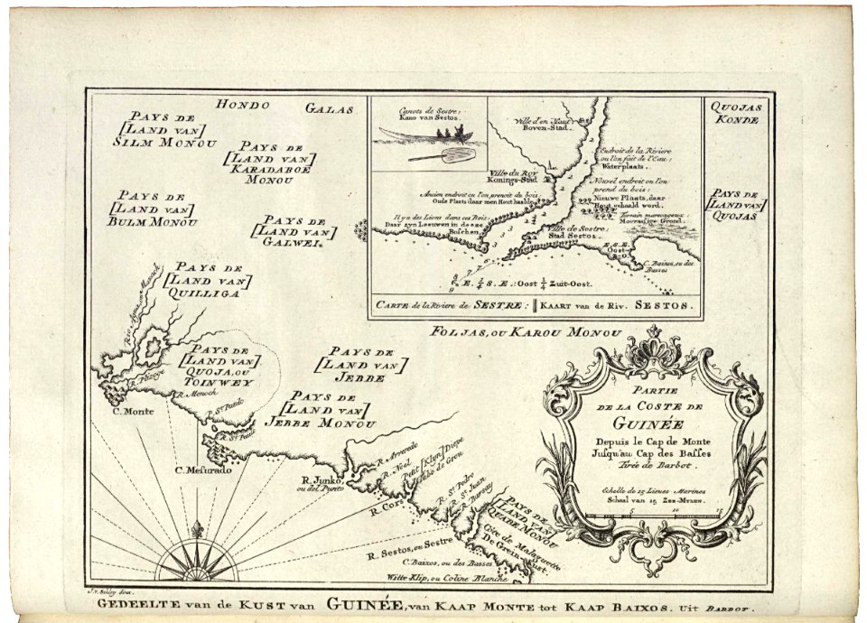
carte particulière des costes de l'afrique qui comprend le royaume de cacheo, le province de gelofo etc. - btv1b8595501g
maps by pieter mortier
maps from the earth and its inhabitants, vol. x
maps of weather and climate of africa
maps from the earth and its inhabitants, vol. xiii
maps indicating exploration
maps from the earth and its inhabitants, vol. xiii
1870s maps of africa
maps from the earth and its inhabitants, vol. xiii
1878 maps of africa
maps of the west-indische compagnie
1747 maps of africa
maps of the west-indische compagnie
1747 maps of africa
maps of the west-indische compagnie
1747 maps of africa
nieuwe en beknopte hand-atlas (1754)
maps of the dutch east india company - mauritius
1753 maps of africa
maps from the earth and its inhabitants, vol. xi
africa in the 1890s
a.de la motraye's travels through europe, asia, and into part of africa (1723) by la mottraye
realism
1101 - 1200 of 1,486
Next page
/ 15